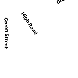
47 HIGH RD
Owner Information
BOUTON CHRISTOPHER M
47 HIGH RD
NEWBURY, MA 01951


Property Details
47 HIGH RD is classified as a Single Family Residential (Colonial).
The primary structure on this property was built in 1922. There are 5,030ft2 of built area within this property. There is 5,030ft2 of residential/living space within this property. This property is listed as having 9 rooms.
47 HIGH RD is valued at $1,337,200. The land is valued at $324,700 and the structures are valued at $969,000. There is an additional valuation of $43,500 on this property.
The most recent deed for 47 HIGH RD is recorded at the local registrar in Book 34885, Page 52. 47 HIGH RD was last sold on Friday, April 29, 2016 for $1.
Assessment data from fiscal year 2022.
Flood Data
According to the FEMA National Flood Hazard Layer, this property does not appear to be in a flood zone. It may also be in an area not yet reviewed. Nonetheless, confirm this information prior to taking any action.
To view the flood hazards around this property, create a FEMA "Firmette" Map of the area around 47 HIGH RD.
Broadband Internet Providers
| Provider | Type | Bandwidth (mbps) | |
|---|---|---|---|
| VSAT Systems, LLC. | Satellite | 2 | 1 |
| HughesNet | Satellite | 25 | 3 |
| GCI Communication Corp. | Satellite | 0 | 0 |
| Viasat Inc | Satellite | 100 | 3 |
| Comcast | Cable | 1000 | 35 |
| Verizon New England Inc. | DSL | 10 | 1 |
Broadband service provider data from December 2020.
Adjacent Properties
- 53 HIGH RD
Single Family Residential owned by LILLY JOSIAH K - 49 HIGH RD
Single Family Residential owned by JOHNSON DEIDRE J - 1 LITTLES LN
Accessory Land with Improvement owned by BUTLER DANIEL - 18 ROLFES LN
Single Family Residential owned by VISCONTI FRANK - 45 HIGH RD
Developable Residential Land owned by BOUTON TTEE KATIE S - 8 R2 ROLFES LN
Single Family Residential owned by JAFFE MICHAEL - 5 LITTLES LN
Other owned by SOC FOR PRES OF NE ANTIQUITIES